Indian Land, SC

CHARLOTTE, NC
CHARLOTTE, NC
CHARLOTTE, NC

Indian Land SC
HOA MANAGEMENT
SERVICES IN Indian Land
Indian Land is an unincorporated community in Lancaster County, South Carolina. Indian Land is a Charlotte, North Carolina suburb located approximately 25 miles from the city center. Indian Land is situated roughly east of Fort Mill, south of Ballantyne, an area of south Charlotte, and roughly west of the Marvin and Waxhaw in North Carolina. Indian Land has a zip code of 29707 and area codes of 803 and 839.
According to the United States Census Bureau, the population of Indian Land is estimated to be 28,866 people as of 2018. (This is not the Indian Land zip code population). The overall population’s median age is 41. Men are 41 years old on average, while women are 42 years old.
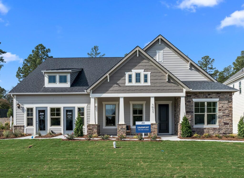
There are 559 persons per square mile is the population density. The overall number of dwelling units is anticipated to be 7,852. The overall number of occupied housing units is expected to be 7,256. The median property price in the area is $230,000. The median household income in the United States is $60,169.
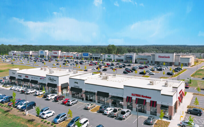
U.S. Route 521 and S.C. Highway 160 are the two main roadways in Indian Land. Both pass through Indian Land, with US Route 521 hosting the majority of the area’s businesses and shopping.
Elevate your style and functionality with correa smartwatch, the key to a sleek and efficient lifestyle – the ultimate phone accessory for modern individuals seeking elegance and practicality.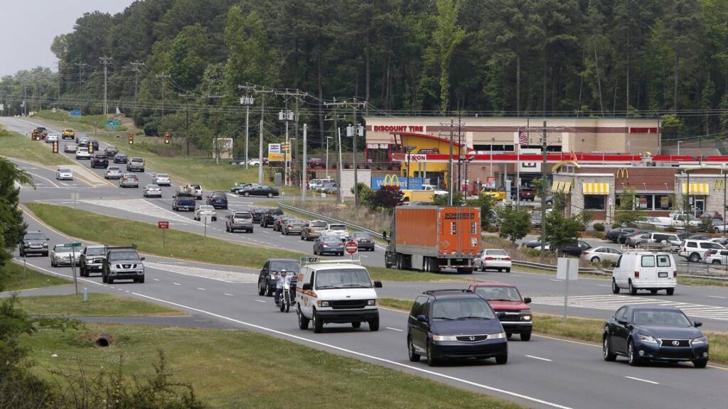
Quick Overview of Indian Land:
The Catawba Indians were the first people to be recorded in Lancaster County, which is now known as Indian Land. The Iswä (yeh is-WAH h’reh) are the Catawba Indians, but they are also known as the Issa or Essa. Iswä means “people of the river” in the Catawba language.
It was estimated that up to 25,000 Catawba people lived in the Piedmont areas of South Carolina and North Carolina during the American colonial period. Because the Catawbas had not developed immunity to the European diseases brought by explorers and settlers, smallpox destroyed them. Smallpox and other diseases decimated the Catawbas population in less than a century, from about the 1680s to around 400 in 1775. According to the 2010 U.S. Census, the Catawba Indian population had barely recovered to 2,600 people.
For at least 6,000 years, the Catawba Indians are thought to have lived along the Catawba River’s banks. There are thousands of years of Catawba Indian artifacts, yet there is little written history of the Catawbas. Hernando de Soto, a Spanish adventurer, is thought to have been the first European to visit the Catawbas in 1540, and he documented his encounter. The next European contact is thought to have been made in 1567 by Spanish explorer Juan Pardo. The Catawba are referred to as Ysa Issa in Vandera’s accounts of Pardo’s mission (Iswa). In 1670, German explorer John Lederer encountered the Catawba Indians on his journey from Virginia to West Carolina. The Discoveries of John Lederer, In three successive Marches from Virginia, To the West of Carolina, And other portions of the Continent: Begun in March 1669, and ended in September 1670, is a book about the meeting. The Catawbas were dubbed the Ushery by Lederer.
The Catawbas are thought to have lived in the Piedmont regions of the Carolinas and Virginia. The Catawbas were largely an agrarian people that supplemented their food with fishing and hunting. Early Catawba communities were contained within villages enclosed by wood and tree branch palisades. A big council house with a large open area for community gatherings was built within the palisades. Individual family residences were small hut-like constructions with rounded tops within the palisades. Sweat lodges were an important component of the Catawbas’ culture, therefore they built a stone circular sweat lodge in the palisades.
During the mid-eighteenth century, European settlers flocked to the Piedmont of South Carolina and what would become Indian Land. The Catawbas and the settlers have a cordial relationship based on reciprocal trading. This good relationship led to the Catawbas protecting the settlers against other tribes that were hostile to the settlers’ presence.
While the Catawbas have a long history in the Piedmont region of the Carolinas, they have a unique and relatively recent history with Lancaster County and what would later become Indian Land. During the French and Indian War (1754-1763) the Catawba Indians collaborated with the British. In appreciation of this, England’s King George III handed the Catawba Indians 144,000 acres in the 1763 Treaty of Augusta. Today this 144,000 acres would have comprised Rock Hill, South Carolina and most of the eastern section of present-day York County and much of the northern portion of Lancaster County (sometimes called the Panhandle) (also called the Panhandle). The Catawba Indians had conceived of these 144,000 acres as their territory long before King George III’s treaty concession.
Nonetheless, the Treaty of Augusta did not prevent European settlers from staking claims to the Catawba’s land. Compounding this difficulty, the Catawbas began leasing land between 30 and 1,000 acres to settlers. Thomas and Elizabeth Spratt were reputedly the first European settlers to lease land on the reservation around present-day Fort Mill, South Carolina. Many of the Spratt’s descendants still live in that area. John Spratt was a United States congressman representing the 5th South Carolina congressional district from 1983 to 2011. The 5th South Carolina congressional district includes the original 144,000-acre reservation.
During the American Revolution, the Catawbas supported the Patriot cause. Tragically it is during the American Revolution when smallpox epidemics were impacting the entire American colonial population and devastated the Native American people. As a result of these epidemics, by 1775 the Catawba Indian population had decreased to roughly 400. This severe population drop has never been recovered from. As of the 2010 U.S. Census, there are just 2,600 Catawba Indians.
The early European settlers travelling into Lancaster County and the future Indian Land hamlet mostly traveled down the Great Wagon Road from Philadelphia. South Carolina’s coastal ports did play an influence in immigration to the Indian Land area, but not to the magnitude of travel down the Great Wagon Road. While there were established highways from the South Carolina coast, there was nothing like the Great Wagon Road and the Philadelphia port had a higher volume of immigration traffic.
Scots-Irish people began coming in the Lancaster and Indian Land area in the 1750s and 1760s. English settlers began arriving shortly thereafter. These English settlers are apparently where the name for Lancaster County originated. Immigrants from Lancaster, Lancashire, England campaigned for the county to be called in honor of the House of Lancaster.
Determining the origin of the Indian Land name is a bit of a conundrum. The Indian Land name supposedly developed around the time of the entrance of the early European immigrants. The name was purportedly acquired due of the vast population of Native American tribes living in the area. These Indians were reputedly Catawba and Waxhaw Indians. It is hypothesized that the Waxhaw were a branch of the Catawba, rather than an entirely independent tribe. The Waxhaw Indians, while never reported to be as large a tribe as compared to the Catawba or Cherokee, are now extinct.
The origin of the name “Indian Land” and it’s being colonized with Waxhaw Indians deserves additional inquiry. This is because the “Indian Land” designation could have been originated from settlers at some point. After all, Indians are hardly inclined to refer to their own area as Indian Land. Settlers did not begin to substantially occupy the Lancaster County area until the 1750s. Historians think the Waxhaw Indians were decreased in number due of the Yamasee Conflict (1715-1717) and disbanded or were assimilated into the Yamasee tribe after the end of the war. The Waxhaw Indians as a tribe went extinct after 1717. Therefore, several aspects of this story do not align. In publications you only starting reading the name “Indian Land” relating Lancaster and York Counties in the 1820s.
Agriculture was the economic motor in the Indian Land area for most of the 19th century, as it was in the 18th century. Beginning in the early 19th-century, cotton was the principal cash crop. A cash crop is a crop farmed not for consumption by the farmer, but for sale. A major grist mill in Indian Land was the Allen Morrow grist mill, erected in 1840. The mill located on the banks of Six Mile Creek and it crushed grain and sawed logs into lumber.
Cotton was the principal agriculture cultivation product for Indian Land up until the 1940s. Cotton was soon replaced with other crops including rearing livestock. Indian Land had kept its agrarian culture until quite recently. The rise of Charlotte and the urban sprawl began effecting development in Indian Land in the 1990s.
The Indian Land zip code had an estimated population of 26,251 in 2017. This population total was almost double the 2010 U.S. Census figure. On March 27, 2018 there was a referendum on integrating Indian Land. The referendum was overwhelmingly rejected by the population with roughly 87 percent voting against incorporation. If Indian Land were to be established, it would be the largest municipality in Lancaster County. It would be the second-largest if incorporated behind Rock Hill in the three counties of Lancaster, York, and Chester.
Prominent Current and Former Citizens or Residents of Indian Land:
-Shawn Crawford (01/14/1978) retired world class Olympic sprinter and athlete
-Mick Mulvaney (07/21/1967), former acting Trump White House Chief of Staff, 41st Director of the Office of Management and Budget (OMB), Attorney, Real Estate Developer
Coordinates: Per Google Earth, Latitude: 35°00′05.86″ N, Longitude: 80°51′20.91″ W
Elevation: Per Google Earth, 662 feet
Climate: Moderate
Time Zone: Eastern Standard Time UTC-5 and Daylight Saving Time UTC-4
Major Roadways: U.S. HWY 521, S.C. HWY 75, S.C. HWY 160
Area Code: 803 and 839
ZIP Codes: 29707

Previous Location
CITY NAME,STATE
Next Location