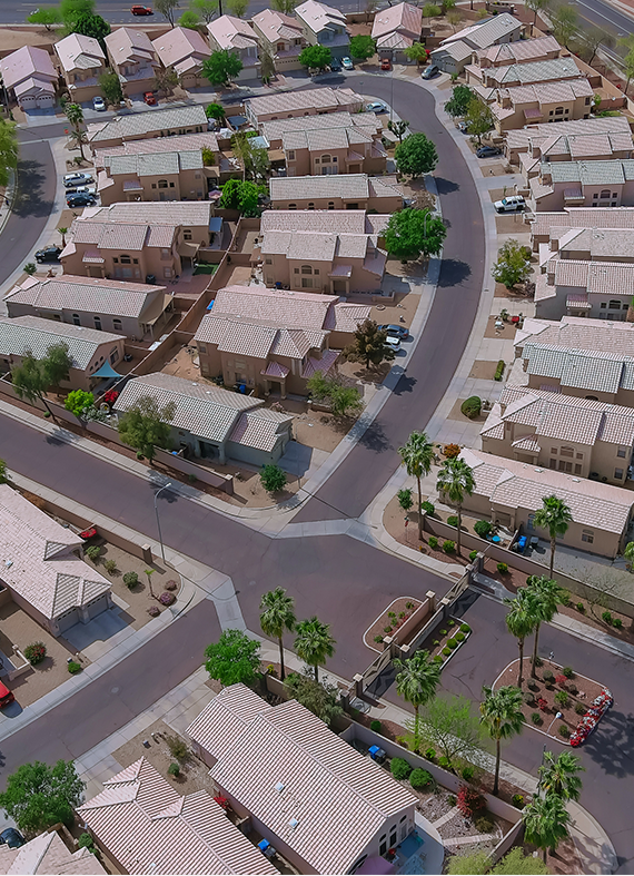
GET STARTED

GET STARTED

Rock Hill, SC

CHARLOTTE, NC

CHARLOTTE, NC

CHARLOTTE, NC

Rock Hill SC

HOA MANAGEMENT
SERVICES IN Rock Hill

Rock Hill, South Carolina, also known as the City of Rock Hill, is the largest municipality within York County. Rock Hill is a Charlotte suburb located approximately 20 miles from the Charlotte city center. “The Gateway to South Carolina” and “Football City USA” are two nicknames for Rock Hill. The population of Rock Hill in 2020 was 74,372 people, according to the United States Census Bureau. The 2010 population of Rock Hill per the United States Census Bureau was 66,154. Rock Hill’s zip codes are 29730, 29731, 29732, 29733, and 29734. The area codes are 803 and 839, respectively.

Rock Hill was incorporated in 1892 after being originally settled around 1852. The origin or birth of Rock Hill can be traced back to the town of Ebenezer (also known as Ebenezerville) when it refused to allow the Charlotte and South Carolina Railroad to run rails through their town. The inhabitants of Ebenezer thought a train would be a nuisance, so the railroad laid its tracks a little more than two miles south of Ebenezer. According to legend, the railroad named or designated an area near those tracks as “rocky hill,” which eventually became the City of Rock Hill. The fate of Ebenezer was that it being unincorporated, it was eventually absorbed into Rock Hill in the 1960s, and it ceased to exist.

A Quick Overview of the Rock Hill Area

The Catawba Indians were the first people historically encountered and recorded by European explorers to habitat the Rock Hill area. The Catawba people were also known as the Issa, Essa, and Iswä. The Catawba word isswä, translates to “people of the river.” The Catawba Indians inhabited areas around the Catawba River. The Catawba River borders Rock Hill to the northeast.

It is estimated that there were over 25,000 Catawba Indians in the Piedmont region during the pre-American colonial period. Diseases (mainly smallpox) that the Catawbas had not been exposed to before they decimated the tribe’s population as Europeans began to arrive in large numbers. Europeans began arriving in the region around the year 1680, but in larger numbers after 1700. Because of the tribe’s constant contact with European newcomers, these diseases tragically reduced the Catawba population to roughly 400 by 1775. According to the 2010 U.S. Census, the Catawba Indian population has barely recovered to 2,600 people.

Before the 17th century, there are little historical written records from the Catawbas. In 1540, Spanish explorer Hernando de Soto made the first recorded European contact with the Catawbas. In 1567, Spanish explorer Juan Pardo is thought to have made the next European contact. This can be seen in Vandera’s accounts of Pardo’s voyage, where the Catawba are called Ysa Issa (Iswa). The third contact was purportedly made in 1670 by German adventurer John Lederer, who referred to them as the Ushery. The Catawba Indians are thought to have lived for 6,000 years along the Catawba River in the Piedmont region of South Carolina, North Carolina, and Virginia.

The Catawbas were primarily an agrarian culture that relied on fishing and hunting to supplement their food supply. Their culture was organized around communities, which were bordered by log and tree branch walled forts. These walled forts were built to keep the community safe from hostile Indian tribes. There was a substantial council structure with a significant open area for tribe gatherings within the village’s fortifications, as well as little huts made of tree bark. The extended family was usually housed in these structures. In addition, within these walled fort settlements, it was typical to find a circular stone sweat lodge. The Catawba Indians’ culture was heavily influenced by the sweat lodge.

The Catawba Indians were known as astute practitioners of commerce. Trading between the Catawbas and the settlers had a significant impact on the Catawba civilization in the 17th century. Deerskins and other animal furs were among the Catawba’s most common trade items, with firearms, knives, textiles, toys, and alcohol being traded by the colonists.

The Catawbas were recognized for being a peaceful and commercially prosperous people, but who were also known as fierce warriors. The Cherokee Indians and the Catawba Indians frequently clashed because of their neighboring territories. For the most part, the Catawbas were generally known to be cordial to the European settlers, with very few exceptions.

During the 18th century, as settlers flocked to the Piedmont region of South Carolina and North Carolina, this strong connection helped to keep the peace. Both the settlers and the Catawbas benefited from the good relations and commerce. Other tribes that were antagonistic to the settlers were in many instances protected by the Catawba. The Catawbas’ ability to trade benefitted their society more than that of other tribes. For a period of time, the Catawbas thrived far more than the majority of other Native American tribes. The Catawba Indians’ access to firearms before rival tribes is the finest example of this, and was an advantage over other tribes.

The Catawba Indians received a 144,000-acre land grant from England’s King George III in 1763. These 144,000 acres is now located in what became York County, South Carolina. The City of Rock Hill now falls within that original 144,000-acre land grant. King George’s land grant was a part of the Treaty of Augusta. The land grant was given to the Catawba in recognition for their assistance to the British during the French and Indian War. Paradoxically before the land grant, the Catawba Indians regarded the area to be theirs anyway. Nonetheless, the Treaty of Augusta was intended to prevent European settlers from further intruding on the Catawba’s land. The treaty was a failure in this aspect.

The Catawbas began leasing sections of the 144,000 acres to settlers immediately after the treaty was signed, essentially eroding the authority of the treaty. Reportedly, these leased parcels ranged in size from 30 to 1,000 acres per settler. There are reports of settlers, leasing far larger plots of land. Farmers Thomas and Elizabeth Spratt, who leased several thousand acres, were reportedly the first inhabitants of European descent on these 144,000 acres. Their many descendants still live in and around Rock Hill, and the surrounding area.

The Catawba Indians backed the Patriot cause during the American Revolution. During this same period, smallpox epidemics ravaged the American colonial population, which included the Native American population. The Native American communities were harmed far more severely than the colonial populations of European heritage. The Catawbas were decimated by smallpox, and by 1775, there were only 400 left. The population of the Catawbas has never fully recovered. Many Catawba Indians were forced to join other tribes that had not been as badly affected by the illnesses due to the dramatic decline in their numbers. A significantly smaller number of Catawbas stayed on their York County tribal reservation.

The settlers or their descendants who had leased the reservation land lobbied the South Carolina legislature to force the Catawbas to relinquish the 144,000 acres in the early nineteenth century. The Treaty of Nations Ford between the Catawbas and the State of South Carolina was signed in 1840 as a result of the declining population of Catawba Indians and the anti-Native American political climate.

The Catawbas were required by this treaty to hand over the 144,000-acre reservation to the state of South Carolina. The treaty’s terms and conditions were most unfavorable to the Catawbas, and it was signed in the shadow of the federal Indian Removal Act of 1830. The Catawbas were promised a new reserve in another part of South Carolina in the Treaty of Nations Ford. The contract also stipulated that the Catawbas were to be monetarily reimbursed. The treaty and the resulting repercussions were not resolved until 1993, when the State of South Carolina reached a $50 million settlement with the Catawba Indians.

In the 1750s and 1760s, the early settlers to York County and the eventual Rock Hill area were mostly Scots-Irish. The Great Wagon Road brought the majority of these in from Pennsylvania. There were difficult colonial roads and trails into South Carolina’s interior, but immigration from the South Carolina coast did not play the same role into the Carolinas as the Great Wagon Road did. The Great Wagon Road’s migration was aided by the increased volume of shipping into Philadelphia as opposed to South Carolina.

The birth of Rock Hill can be traced to the town of Ebenezer that did not want the Charlotte and South Carolina Railroad to lay railroad tracks in their town, so tracks were laid two miles south. Folklore has it that the railroad named or designated an area near those tracks as “rocky hill,” which evolved into “Rock Hill.” The future Rock Hill was settled around 1852 with the arrival of the railroad, and was incorporated in 1892. The fate of Ebenezer was that it was absorbed into Rock Hill in the 1960s.

The Charlotte and South Carolina Railroad, as with most all railroads, accelerated the growth of most towns and cities, Rock Hill being no exception. In fact, the railroad is probably the only reason Rock Hill even exists. The Charlotte and South Carolina Railroad ran for 110 miles, the network stretched from Charlotte, North Carolina, to Columbia, South Carolina. For Monday through Saturday in 1854, the daily rail itinerary showed a departure from Charlotte at 4:40 a.m., an arrival in Columbia at 11:15 a.m., a departure from Columbia at 4:20 p.m., and an arrival in Charlotte at Midnight. On Sundays, there was no scheduled service. The fare was $2.00 for the round trip. In today’s dollars that round trip ticket would cost $66.94.

This railroad was built with the help of local businessmen who needed a better way to get their goods to market. Between Columbia and Charleston, there was already a rail connection that opened in 1842. The Charlotte and South Carolina Railroad would link the region to the Charleston port, allowing the region’s products to reach additional domestic and international markets. At this time cotton was the main agricultural product.

The area’s Springs and White families were early investors in the Charlotte and South Carolina Railroad and were instrumental in its growth. John Springs, III, a large cotton farmer, was an early investor. Cotton planters themselves, the Whites gained enormously from the railroad. The Charlotte and South Carolina Railroad has been dubbed “the most important economic determinant in the history of Charlotte and the surrounding counties.”

For most of the 18th and 19th centuries, agriculture was the principal source of income in the Rock Hill area. Cotton cultivation grew more common in the 1830s and 1840s, and it remained the primary crop far into the twentieth century. Corn was grown instead of cotton during the American Civil War because cotton could not be exported. Cotton, on the other hand, has always been the most profitable cash crop. (A cash crop is one that is raised purely for the purpose of selling and not for the farmer’s own consumption.)

With the entrance of textile manufacturing in the late 1800s, the area’s economic reliance on agriculture began to decrease. The textile industry was the main economic force in Rock Hill and the neighboring area at the turn of the twentieth century. All of that changed in the 1980s and 1990s, when imported textiles began to supplant domestic manufacturing. One reason for this hastened fall of local textile production: the North American Free Trade Deal (NAFTA). NAFTA was a trade agreement between the United States, Canada, and Mexico that was adopted in 1993. Employment trends in textile manufacturing had already been declining for some time; however, NAFTA accelerated this trend.

Even though agriculture production had declined in the early part of the 20th century and textile manufacturing declined in Rock Hill and the surrounding area in the latter part of the 20th century, the overall economy swiftly recovered. This was due to two factors: the broader economic base that has grown in Rock Hill and York County, and the proximity to Charlotte’s strong economic engine. Many of the areas south of the North Carolina border, including Rock Hill, have become bedroom communities for Charlotte’s workforce. The excellent school system, as well as the cheaper taxes, are major draws for these commuters. On the South Carolina side of the border, there has been a great deal of economic success because of lower taxes and the State of South Carolina’s business economic development incentives.

Previous Location

CITY NAME,STATE

Next Location

CITY NAME,STATE